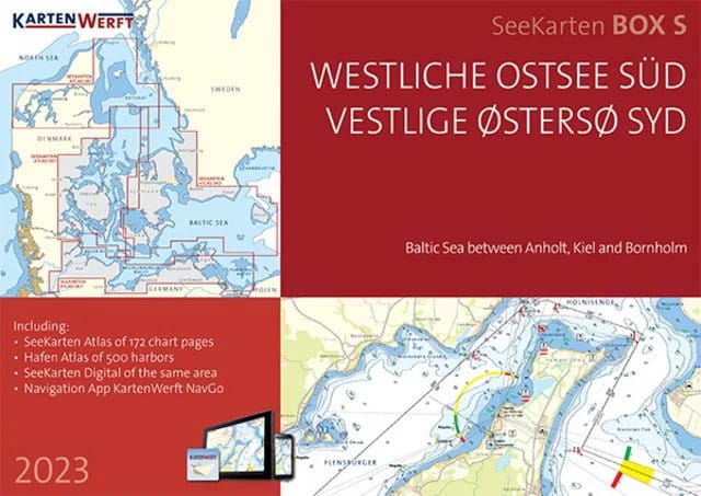
 9023-111 KARTENWERFT SeeKarten Box Westl. Ostsee Süd: DE1, DK1, DK2
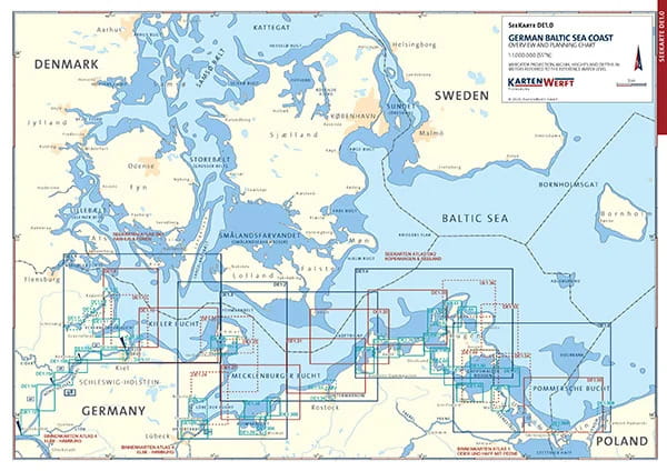
 9023-111 KARTENWERFT SeeKarten Atlas DE1 Deutsche Ostseeküste


from €199.90*
€199.90*
Prices incl. VAT plus shipping costs
Available, delivery time: 1 Tag
In stock
Three nautical chart atlases in handy, ring-bound A3 format are combined in the nautical chart boxes Western Baltic Sea North (DK1, DK2, DK3) and Western Baltic Sea South (DE1, DK1, DK2).
Data from the Federal Maritime and Hydrographic Agency (BSH), the Danish Geodata Agency (DGA) and the Swedish Maritime Administration (SMA) are presented in an attractive layout for the well-chosen area sections of the atlases. The charts offer a clear structure, catchy symbols, texts in German and Danish and terms and brief information in English.
The SeaChart Box Western Baltic Sea North consists of:
- the atlases DK1, DK2 and DK3, which cover the area between Anholt, Kiel and Bornholm
- 19 area charts at a scale of 1:360,000 to 1:240,000
- 56 coastal charts at a scale of 1:120,000 to 1:80,000
- 124 detailed charts at a scale of 1:40,000 to 1:20,000
The SeaChart Box Western Baltic Sea South consists of
- the atlases DK1, DK2 and DE1, which cover the area between Thyborøn (Limfjord), Skagen, Flensburg and Bornholm
- 19 area charts at a scale of 1:360,000 to 1:240,000
- 62 coastal charts at a scale of 1:120,000 to 1:80,000
- 146 detailed charts at a scale of 1:40,000 to 1:20,000
The nautical charts can also be used digitally in the Kartenwerft Navgo app (Android and iOS) - free of charge and unlimited.
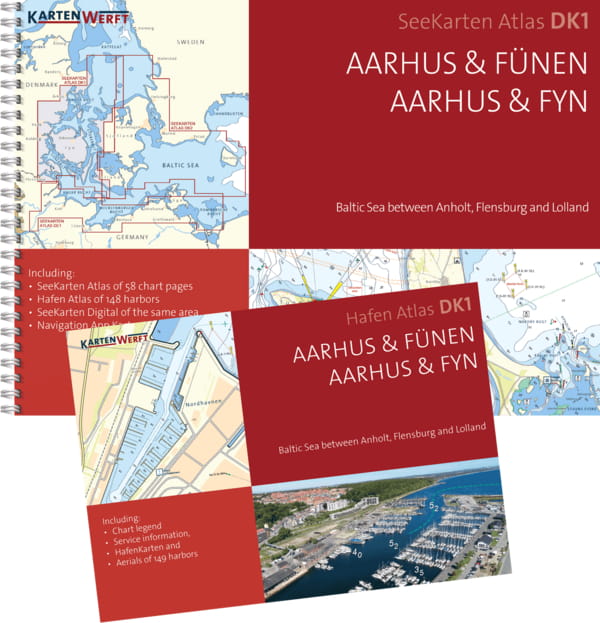
The three enclosed port atlases in A4 format present around 500 ports in the North box and 373 ports in the South box in aerial photos and port maps (1:7,500 - 1:5,000).
As an area service, updates of the area information and reports are available during the season.
The charts are protected from splash water in the transparent plastic cover.
The chart atlas is published annually before the start of the season, updated up to and including issue 8 of "Nachrichten für Seefahrer".
| Art. No. | area | model | Price (exemplar) | Delivery time | Note list | Buy |
|---|
Three nautical chart atlases in handy, ring-bound A3 format are combined in the nautical chart boxes Western Baltic Sea North (DK1, DK2, DK3) and Western Baltic Sea South (DE1, DK1, DK2).
Data from the Federal Maritime and Hydrographic Agency (BSH), the Danish Geodata Agency (DGA) and the Swedish Maritime Administration (SMA) are presented in an attractive layout for the well-chosen area sections of the atlases. The charts offer a clear structure, catchy symbols, texts in German and Danish and terms and brief information in English.
The SeaChart Box Western Baltic Sea North consists of:
- the atlases DK1, DK2 and DK3, which cover the area between Anholt, Kiel and Bornholm
- 19 area charts at a scale of 1:360,000 to 1:240,000
- 56 coastal charts at a scale of 1:120,000 to 1:80,000
- 124 detailed charts at a scale of 1:40,000 to 1:20,000
The SeaChart Box Western Baltic Sea South consists of
- the atlases DK1, DK2 and DE1, which cover the area between Thyborøn (Limfjord), Skagen, Flensburg and Bornholm
- 19 area charts at a scale of 1:360,000 to 1:240,000
- 62 coastal charts at a scale of 1:120,000 to 1:80,000
- 146 detailed charts at a scale of 1:40,000 to 1:20,000
The nautical charts can also be used digitally in the Kartenwerft Navgo app (Android and iOS) - free of charge and unlimited.
The three enclosed port atlases in A4 format present around 500 ports in the North box and 373 ports in the South box in aerial photos and port maps (1:7,500 - 1:5,000).
As an area service, updates of the area information and reports are available during the season.
The charts are protected from splash water in the transparent plastic cover.
The chart atlas is published annually before the start of the season, updated up to and including issue 8 of "Nachrichten für Seefahrer".
Similar products
Last seen products
More articles from this category


