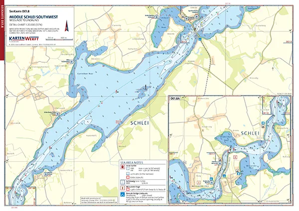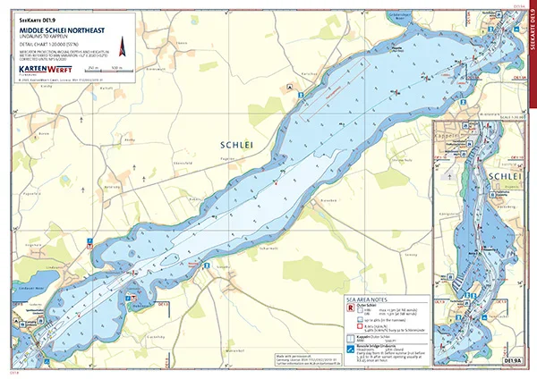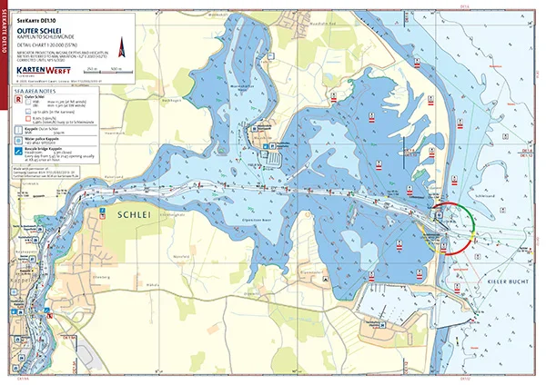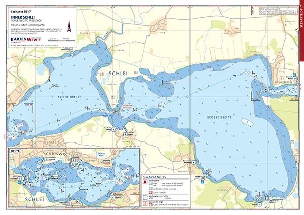

High-quality laminated individual charts of the Schlei from the KARTENWERFT SeeKarten Atlas DE1 German Baltic Sea Coast.

The SeeKarten charts are ideal for use on smaller vessels such as dinghies, dinghy cruisers, canoes and fishing boats. They are handy, robust, weatherproof and anti-reflective thanks to the matt lamination. They contain all relevant information for skipper and crew.

DIN A3 format, laminated, weatherproof, scale 1:20,000.

The sheet with the two SeeKarten DE1.7 | DE1.8 includes Innere Schlei and Mittlere Schlei Südwest, i.e. covers the Schlei from Kleine Breite near Schleswig to Lindaunis.

The sheet with the two lake charts DE1.9 | DE1.10 includes the Middle Schlei Northeast and Outer Schlei, i.e. it covers the Schlei from Lindaunis to Schleimünde.

Similar products

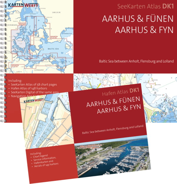
KARTENWERFT Nautical charts Atlas DK1 Aarhus & Funen
Nautical chart atlas in handy, ring-bound A3 format.Data from the Federal Maritime and Hydrographic Agency (BSH) and the Danish Geodata Agency (DGA) are presented in an attractive layout for the well-chosen sections of the area. The maps offer a clear structure, catchy symbols, texts in German and Danish and terms and brief information in English.The atlas consists of:5 to 8 area charts (scale 1:240,000)9 to 25 coastal charts (1:120,000 to 1:80,000)37 to 59 detailed charts at a scale of 1:40,000 to 1:20,000The nautical charts can also be used digitally in the Kartenwerft Navgo app (Android and iOS) - free of charge and unlimited.The accompanying port atlas in A4 format presents 74 to 202 ports in aerial photos and port maps (1:5,000 - 1:6,000).As an area service, updates of the area information and reports are available during the season.The charts are protected from splash water in the transparent plastic cover.The chart atlas is published annually before the start of the season, updated up to and including issue 8 of "Nachrichten für Seefahrer".Three chart atlases each are combined in the chart boxes Western Baltic Sea North (DK1, DK2, DK3) and Western Baltic Sea South (DE1, DK1, DK2).

From €79.90 *
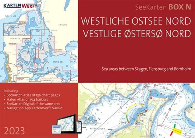
KARTENWERFT SeaChart Box Western Baltic Sea
Three nautical chart atlases in handy, ring-bound A3 format are combined in the nautical chart boxes Western Baltic Sea North (DK1, DK2, DK3) and Western Baltic Sea South (DE1, DK1, DK2).Data from the Federal Maritime and Hydrographic Agency (BSH), the Danish Geodata Agency (DGA) and the Swedish Maritime Administration (SMA) are presented in an attractive layout for the well-chosen area sections of the atlases. The charts offer a clear structure, catchy symbols, texts in German and Danish and terms and brief information in English.The SeaChart Box Western Baltic Sea North consists of:the atlases DK1, DK2 and DK3, which cover the area between Anholt, Kiel and Bornholm19 area charts at a scale of 1:360,000 to 1:240,00056 coastal charts at a scale of 1:120,000 to 1:80,000124 detailed charts at a scale of 1:40,000 to 1:20,000The SeaChart Box Western Baltic Sea South consists ofthe atlases DK1, DK2 and DE1, which cover the area between Thyborøn (Limfjord), Skagen, Flensburg and Bornholm19 area charts at a scale of 1:360,000 to 1:240,00062 coastal charts at a scale of 1:120,000 to 1:80,000146 detailed charts at a scale of 1:40,000 to 1:20,000The nautical charts can also be used digitally in the Kartenwerft Navgo app (Android and iOS) - free of charge and unlimited.The three enclosed port atlases in A4 format present around 500 ports in the North box and 373 ports in the South box in aerial photos and port maps (1:7,500 - 1:5,000).As an area service, updates of the area information and reports are available during the season.The charts are protected from splash water in the transparent plastic cover.The chart atlas is published annually before the start of the season, updated up to and including issue 8 of "Nachrichten für Seefahrer".

From €222.32 *

Last seen products

More articles from this category

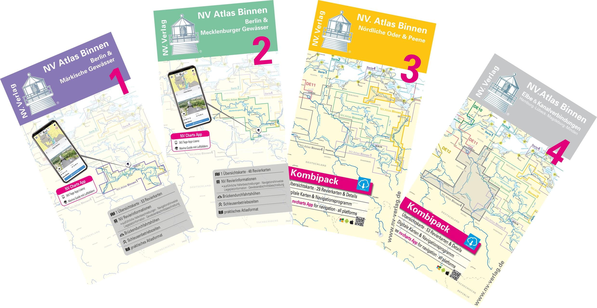
NV CHARTS Maps "Internal waterways""
The NV Charts Sportschiffahrtskarten Binnen are a colour chart series at a scale of 1:35,000 specially designed for inland waters. The charts have been designed to provide precise information that is practical to use. Large-scale details and concise texts provide information on water depths, clearance heights, locks, moorings and places of interest.An index and an overview map make finding the area quick and easy. An emblem on each page indicates the location in the area. The logical, clear layout facilitates orientation, as does the kilometre marker at the edge of the map. The multi-volume map series is rounded off with red-coloured danger spots and views of prominent points.All NV Charts charts also contain an access code to the digital nautical charts in the NV Charts app. These can be easily downloaded and used for offline navigation with the NV Charts app on iOS, Android, PC and Mac or in a web browser.Format 40 x 21 cm, spiral binding folder, incl. activation code for the NV App.

From €35.00 *
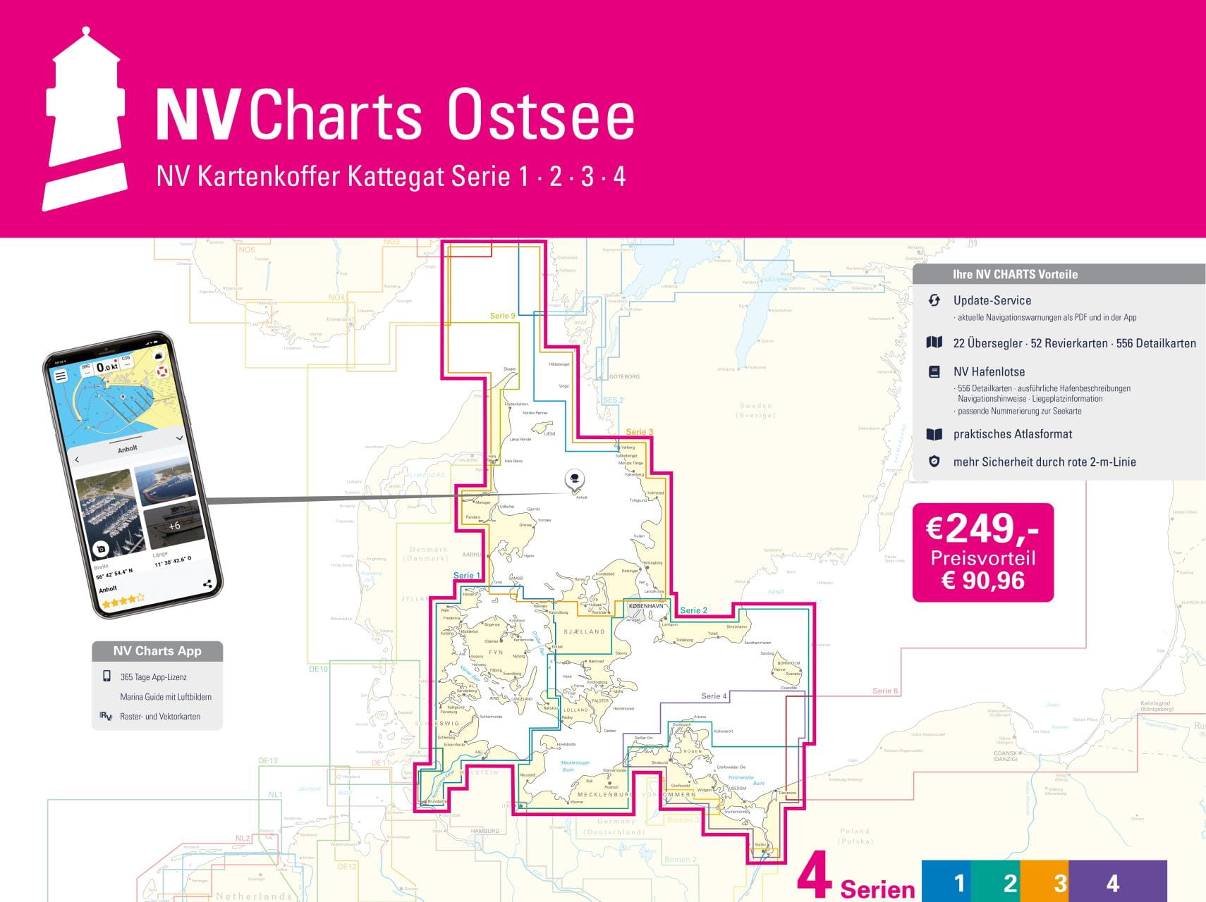
NV CHARTS Chart Box Baltic Sea series 1-4
The Baltic Sea from Skagen to Bornholm: The Baltic Sea chart sets 1-4 of the sport boat chart publisher NAUTISCHE VERÖFFENTLICHUNGEN we also supply as a complete package in a practical transparent plastic case at an attractive preferential price. The proven handy charts are arranged in sets according to cruising areas. All information is specially prepared for the requirements of recreational boating.The Baltic Sea case includes20 Passage Charts42 Coastal charts & detailed chartsnv charts app and navigation software 365 days licencenew: Vector charts downloadHarbour Pilot in paper / digital in German and EnglishNavigation instructions in GermanMeets legal requirement for up-to-date paper nautical charts on board pleasure boatsAll NV Verlag / NV Charts also include an access code to the digital nautical charts in the NV Charts app and can thus be easily downloaded. The charts can be used for 365 days from activation for offline navigation with the NV Charts App on iOS, Android, PC and Mac or also in the web browser.Updated editions of the charts are published annually (usually in March). Up-to-date nautical charts are the basis of safe navigation. NV Charts offers a monthly correction service for its nautical charts from April to October.Chart format 60 x 42 cm.All four chart sets in transparent plastic case.German edition.

€249.00 *
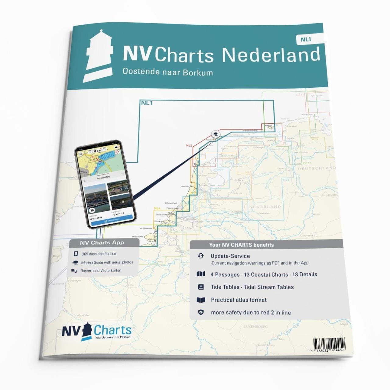
NV CHARTS Atlas Nederland
The publisher NV Charts also offers its usual DIN A2 charts as NV Charts atlases. Here, the format of the nautical charts is optimised for use on yachts and pleasure boats.With the fold and the stitching in the middle of the chart, the nautical chart set becomes a booklet in the handy DIN A3 format. The size of the nautical charts remains the same and all details are preserved. The very flat stapling allows easy work with the course triangle even when the nautical chart is opened.The size of the atlases and the chart format (unfolded) correspond to the NV Charts sports boat combi-packs.Contents of each atlas:oversailerarea charts and detailed chartsharbour mapsMonthly, free correction service of the current nautical charts in season (April - October) as downloadNVCharts app for mobile devices (iOS and Android) for free downloadclear pocketThe scope of the atlases and the chart format (unfolded) correspond to the NV Charts sports boat combi-packs.Atlas in handy DIN A3 format (42 x 30 cm). Size of the unfolded nautical chart: DIN A2 (42 x 60 cm).The new nautical charts are published around middle of March.

From €65.00 *
KARTENWERFT Nautical charts Atlas DK1 Aarhus & Funen
Nautical chart atlas in handy, ring-bound A3 format.Data from the Federal Maritime and Hydrographic Agency (BSH) and the Danish Geodata Agency (DGA) are presented in an attractive layout for the well-chosen sections of the area. The maps offer a clear structure, catchy symbols, texts in German and Danish and terms and brief information in English.The atlas consists of:5 to 8 area charts (scale 1:240,000)9 to 25 coastal charts (1:120,000 to 1:80,000)37 to 59 detailed charts at a scale of 1:40,000 to 1:20,000The nautical charts can also be used digitally in the Kartenwerft Navgo app (Android and iOS) - free of charge and unlimited.The accompanying port atlas in A4 format presents 74 to 202 ports in aerial photos and port maps (1:5,000 - 1:6,000).As an area service, updates of the area information and reports are available during the season.The charts are protected from splash water in the transparent plastic cover.The chart atlas is published annually before the start of the season, updated up to and including issue 8 of "Nachrichten für Seefahrer".Three chart atlases each are combined in the chart boxes Western Baltic Sea North (DK1, DK2, DK3) and Western Baltic Sea South (DE1, DK1, DK2).

From €79.90 *