ASTRONAVIGATION - ENDLICH ZEITGERECHT von Helmut Hoffrichter
 9056-005 ASTRONAVIGATION - ENDLICH ZEITGERECHT von Helmut Hoffrichter
 9056-005 ASTRONAVIGATION - ENDLICH ZEITGERECHT von Helmut Hoffrichter Inhv. 1
 9056-005 ASTRONAVIGATION - ENDLICH ZEITGERECHT von Helmut Hoffrichter Inhv. 2


ASTRONAVIGATION - ENDLICH ZEITGERECHT von Helmut Hoffrichter
€35.00*
€35.00*
Prices incl. VAT plus shipping costs
Astronavigation has the status of a secret science from the last millennium - interesting, demanding, completely outdated and far too strenuous. Most water sports enthusiasts only study it - if at all - in preparation for an exam, such as the German Sporthochseeschifferschein (SHS) or the British RYA Yachtmaster Ocean.
In the event of a total power failure on board or interference with satellite signals, astronavigation is still regarded as THE backup for GPS & Co. But who can really switch to the navigation system of our ancestors on an ad hoc basis or even has the necessary nautical documents on board?
Helmut Hoffrichter has developed a completely computerised method of determining location using the sun and a sextant, which he calls ‘postmodern astronavigation’. The revised, expanded 2025 edition of his book "Postmodern Astronavigation. Travelling with the sun" has been published.
The book begins with an easy-to-understand review of the history of astronomical navigation. Hoffrichter then introduces his self-developed app ‘Circle of position navigation’ (Apple) and ‘Sun Navigation’ (Android).
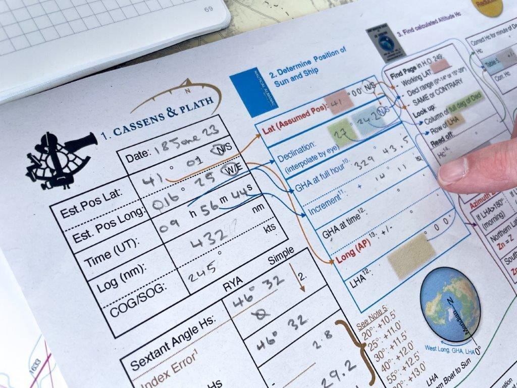
A sextant is used to measure the distance to the unmistakable sun. For the sake of simplicity, planets and fixed stars are left out as natural celestial bodies. After measuring the elevation angle, astronavigation traditionally begins with an extensive mathematical calculation and then a graphical approximation method. This was devised in 1875 by the French naval officer Marcq Saint-Hilaire (1832-1889) as an ‘emergency solution’ that was solely due to its time.
Although mathematically exact navigation methods have been known since the mid-18th century, the calculation could not be automated without a computer. In Hoffmeister's app, the elevation angle measurements can simply be entered on a mobile device. Of course, the tablet or smartphone would have to run independently of the on-board power supply failure.
The long-displaced methods of mathematicians Johannes Keppler (1571-1630) and Leonhard Euler (1707-1783) as well as the ephemeris are stored in the software, which performs the location calculation at lightning speed. After using the sextant, ‘postmodern astronavigation’ is as easy to use as the familiar satellite navigation on the chart plotter. Extensive nautical documentation is not required, nor do you have to do any calculations or drawings yourself.
With ‘postmodern astronavigation’, a location can be determined more precisely with the help of the sun than with the Saint Hilaire altitude difference method. Since this does not even require a gissort, the art of earlier navigators is simplified to such an extent that a genuine, easy-to-use, practical navigation backup is now available.
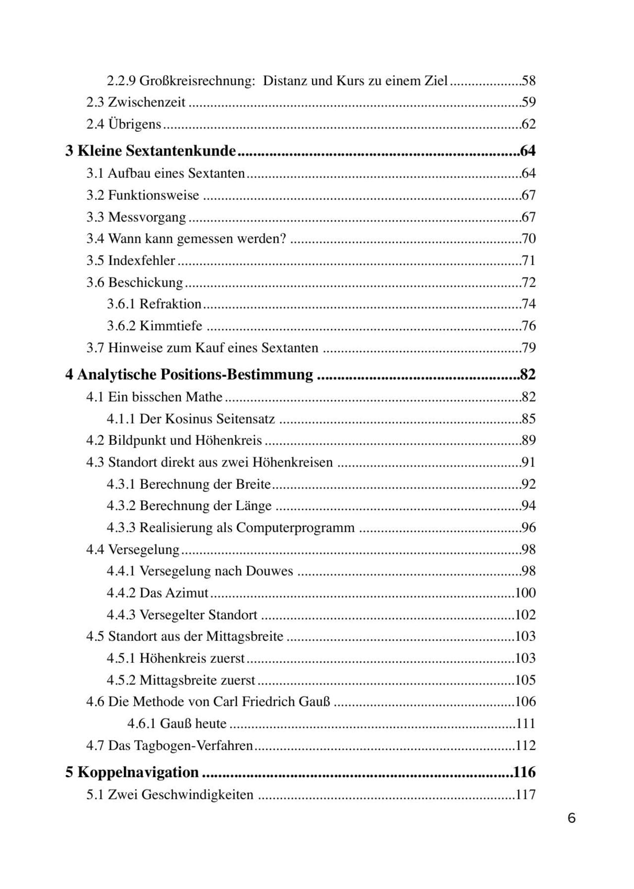
The chapters in detail
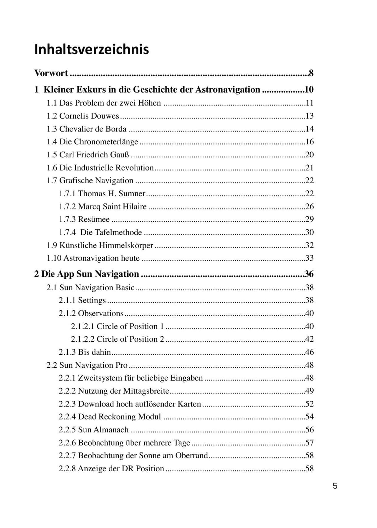
- History of astronavigation
- The Sun Navigation app
- A little sextant lore
- Analytical position determination
- Dead reckoning
- Great circle calculation
- The equation of time
- Appendix, including an extract from the 1809 publication by Carl Friedrich Gauss (1777-1855) in which he solves the two-height problem
188 pages, 70 illustrations and 15 tables, format 14.8 x 21 cm, hardback. German edition.
| Art. No. | description | Unit price | Delivery time | Note list | Buy |
|---|
Astronavigation has the status of a secret science from the last millennium - interesting, demanding, completely outdated and far too strenuous. Most water sports enthusiasts only study it - if at all - in preparation for an exam, such as the German Sporthochseeschifferschein (SHS) or the British RYA Yachtmaster Ocean.
In the event of a total power failure on board or interference with satellite signals, astronavigation is still regarded as THE backup for GPS & Co. But who can really switch to the navigation system of our ancestors on an ad hoc basis or even has the necessary nautical documents on board?
Helmut Hoffrichter has developed a completely computerised method of determining location using the sun and a sextant, which he calls ‘postmodern astronavigation’. The revised, expanded 2025 edition of his book "Postmodern Astronavigation. Travelling with the sun" has been published.
The book begins with an easy-to-understand review of the history of astronomical navigation. Hoffrichter then introduces his self-developed app ‘Circle of position navigation’ (Apple) and ‘Sun Navigation’ (Android).
A sextant is used to measure the distance to the unmistakable sun. For the sake of simplicity, planets and fixed stars are left out as natural celestial bodies. After measuring the elevation angle, astronavigation traditionally begins with an extensive mathematical calculation and then a graphical approximation method. This was devised in 1875 by the French naval officer Marcq Saint-Hilaire (1832-1889) as an ‘emergency solution’ that was solely due to its time.
Although mathematically exact navigation methods have been known since the mid-18th century, the calculation could not be automated without a computer. In Hoffmeister's app, the elevation angle measurements can simply be entered on a mobile device. Of course, the tablet or smartphone would have to run independently of the on-board power supply failure.
The long-displaced methods of mathematicians Johannes Keppler (1571-1630) and Leonhard Euler (1707-1783) as well as the ephemeris are stored in the software, which performs the location calculation at lightning speed. After using the sextant, ‘postmodern astronavigation’ is as easy to use as the familiar satellite navigation on the chart plotter. Extensive nautical documentation is not required, nor do you have to do any calculations or drawings yourself.
With ‘postmodern astronavigation’, a location can be determined more precisely with the help of the sun than with the Saint Hilaire altitude difference method. Since this does not even require a gissort, the art of earlier navigators is simplified to such an extent that a genuine, easy-to-use, practical navigation backup is now available.
The chapters in detail
- History of astronavigation
- The Sun Navigation app
- A little sextant lore
- Analytical position determination
- Dead reckoning
- Great circle calculation
- The equation of time
- Appendix, including an extract from the 1809 publication by Carl Friedrich Gauss (1777-1855) in which he solves the two-height problem
188 pages, 70 illustrations and 15 tables, format 14.8 x 21 cm, hardback. German edition.
Last seen products
More articles from this category

